“The chance of a major, catastrophic earthquake similar to the 2011 Tohoku (east Japan) earthquake, or 2011 Christchurch (New Zealand) earthquake striking Seattle in the next 50 years is approximately 15% to 20% (based on a 5% chance of a M6.5 or larger Seattle Fault Zone earthquake and a 14% chance of a M9.0 Cascadia Subduction Zone earthquake (Steele 2013)). Less catastrophic, but more frequently occurring earthquakes, such as the 2001 Nisqually earthquake, are also concerns. There is an approximately 84% chance there will be another earthquake similar to the M6.8 Nisqually earthquake in Seattle in the next 50 years (Steele 2013).” – Seattle Public Utilities Executive Summary
BEFORE AN EARTHQUAKE
DURING AN EARTHQUAKE
AFTER AN EARTHQUAKE
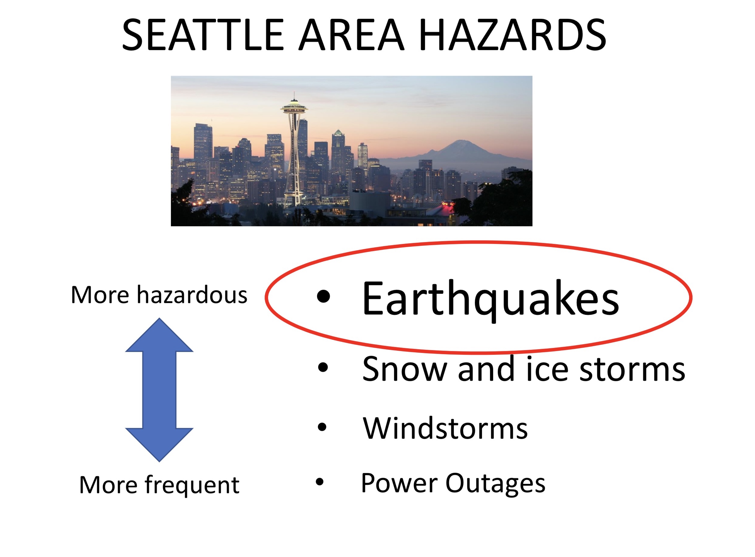
Seattle has a comprehensive evaluation of disastrous threats to the city and #1 is an earthquake due to how destructive it could be.

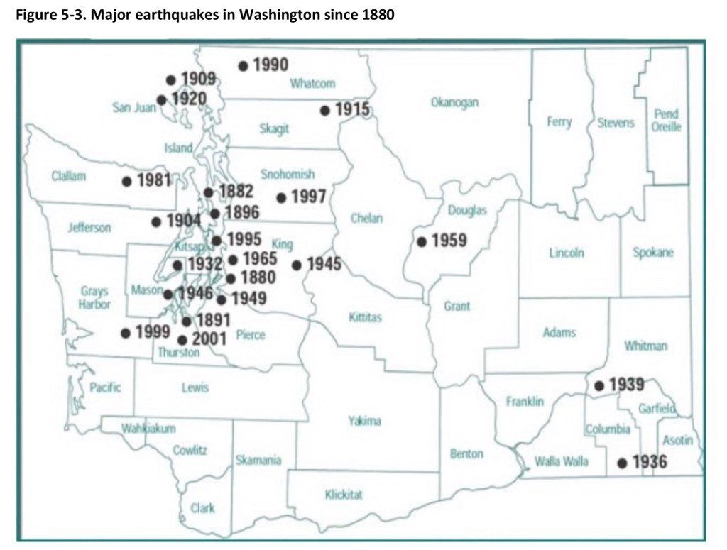
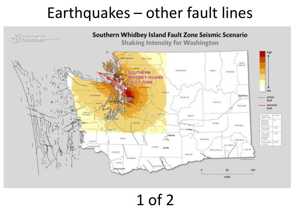
Seattle has three faults, including one that cuts right across the city. The most commonly known earthquake threat is, “the big one,” from a Ring of Fire/ Cascadia Subduction Zone earthquake; also known as “mega-thrust” or “mega-quakes.”
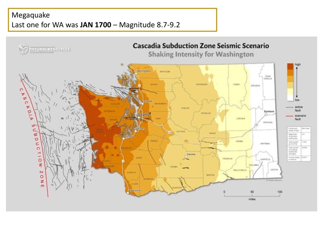
Basically think of everything west of I-5 being destroyed or severely damaged.
The least known Seattle fault threat is the Whidbey Island faults – this would impact directly north of Seattle as well as the San Juan islands. The 2019 Three Lakes quake was from this zone.
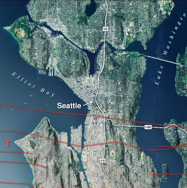
Lastly, the Seattle Fault Zone, which runs directly through Bainbridge Island, the International District (down by the stadiums) and right across the I-90 turn off.
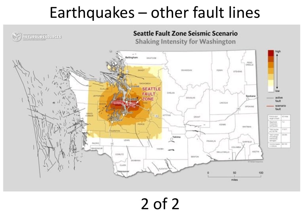

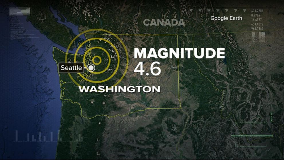
These maps are from a great KING 5 article on Seattle earthquakes found HERE.